2 New Airport Diagram T-Shirts added to collection

We’ve added two new airport diagram t-shirt designs to our popular line – Lake Hood Seaplane Base and Daytona Beach International airport. These t-shirts are a must have for any pilot or aviation enthusiast, and are perfect for hanging out at your favorite airshow or in the hangar. Here are all 6 airport diagram t-shirts.
NEW! Daytona Beach International Airport (KDAB)

Show your love for one of the country’s most storied airports. Daytona Beach’s sand was known for having a smooth, hard, and relatively clean surface for motor vehicles which would frequently race on it. Pilots soon realized the effectiveness of the compact sand and began using the beach as a runway. Historically, the first twin-engine aircraft ever flown left the ground at Daytona Beach. Today it boasts 3 runways, a six-gate domestic terminal, and an international terminal. Daytona Beach is also the headquarters of Embry-Riddle Aeronautical University, one of the largest and most successful aviation programs in the country. T-shirt features coordinates and elevation.


Shop Daytona Beach Airport Diagram T-shirt
*
*
NEW! Lake Hood Seaplane Base Airport Diagram T-shirt (PALH)

Show your love for seaplanes and the Alaskan way of life with this comfortable ring-spun cotton blend t-shirt. This isn’t your ordinary airport diagram. The Lake Hood Seaplane Base is the world’s busiest seaplane base, handling an average of about 190 flights per day. It is located on Lakes Hood and Spenard next to Ted Stevens Anchorage International Airport three miles from downtown Anchorage, Alaska. During the winter months the frozen lake surface is maintained for ski-equipped airplanes. The Lake Hood Strip is a gravel runway located adjacent to the seaplane base. See it all with this airport diagram T-shirt.


Shop Lake Hood Seaplane Base Airport Diagram T-shirt
*
*
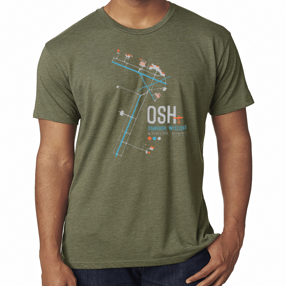
Oshkosh Airport Diagram T-shirt

Celebrate your favorite fly-in destination with this airport diagram t-shirt. Each year hundreds of thousands of pilots and aviation enthusiasts embark on Wittman Regional Airport for a week-long airshow filled with warbirds, experimental aircraft, and the latest in aviation gear. Fly in, camp next to your airplane, and enjoy the show. Don’t forget to rock your wings and land on the dot. T-shirt includes coordinates and elevation.

Shop Oshkosh Airport Diagram tshirt
*
*
Meigs Field Airport Diagram T-shirt

Merrill C. Meigs Field Airport was a single-runway airport in Chicago that was in operation from 1948 until 2003, on Northerly Island, an artificial peninsula on Lake Michigan. By 1955, Meigs had become the busiest single-strip airport in the United States. Chicago mayor Richard M. Daley forced the closing of Meigs in 2003 by ordering the overnight bulldozing of its runway without notice. City crews made the runway unusable by bulldozing large X-shaped gouges into the runway surface. The beloved airport remains closed while the city has made Northerly Island into a park.


MEIGS AIRPORT T-SHIRT
Shop Meigs Airport Diagram T-shirt
*
*
Aspen Airport Diagram T-shirt

Aspen/Pitkin County Airport sits at 7,820’ above sea level in a picturesque valley near Aspen, Colorado. Also known as Sardy Field, this single runway is subject to unpredictable weather and variable winds, making it one of the more extreme airports in the U.S. Nestled in the Rocky Mountains, this one-way in, one-way out airport provides dramatic scenery and a truly unique instrument approach making it a bucket list airport for any adventurous pilot.


ASPEN COLORADO AIRPORT T-SHIRT
Shop Aspen Airport Diagram T-shirt
*
*
First Flight Airport Diagram T-shirt

Celebrate the world’s first successful powered flight with this airport diagram t-shirt. Owned by the U.S. National Park Service, this airport is famous for being the site of hundreds of pre-flight gliding experiments carried out by the Wright brothers. Check out the Wright Brothers Memorial, a 60-foot granite pylon monument and museum on the grounds.


KILL DEVIL HILLS AIRPORT TSHIRT
Shop First Flight Airport Diagram T-shirt
*
*
Catalina Island Airport Diagram T-shirt

Catalina Island Airport (KAVX) dubbed “the airport in the sky,” is a privately-owned airport located 6.4 miles northwest of Avalon, California, in the middle of Catalina Island. The airfield lies near the island’s highest point at an elevation of 1,602 ft. On either end there are dramatic cliffs rolling down Catalina Island into the Pacific Ocean below, making it one of the most scenic and challenging approaches a pilot can tackle. Celebrate this one-of-a-kind airport with our airport diagram t-shirt.


Shop Catalina Island Airport Diagram T-shirt


Leave a Reply
Want to join the discussion?Feel free to contribute!